
Großglockner High Alpine Road
Build a five-day Salzburg circuit through Zell am See, the Großglockner road, Heiligenblut, Lienz and Mittersill.
- Allow
- 5 days
- Route
- 379 km
- Drive time
- 5 hr 35 min
- Stops
- 8
The Großglockner High Alpine Road is a destination road: a tolled, seasonal crossing from Fusch to Heiligenblut with visitor centers, signed viewpoints and access toward Kaiser-Franz-Josefs-Höhe. It deserves a full weather window rather than a dash between hotels.
This circuit continues through East Tyrol and returns via the Felbertauern corridor, turning the pass into a journey rather than an out-and-back. Check the official opening status on the morning itself; snow, wind and maintenance outrank every reservation.
The road, in one glance
Pinch or scroll with Ctrl / ⌘ to zoom
Drawing the route…
The route earns
its distance
Each pin is selected as a place to do something—not merely proof that you passed through.
- 01Salzburg
- 02Zell am See
- 03Fusch an der Großglocknerstraße
- 04Fuscher Törl & Edelweißspitze
- 05Kaiser-Franz-Josefs-Höhe
- 06Heiligenblut
- 07Lienz
- 08Mittersill
 Photo: Jorge Franganillo · CC BY 2.0
Salzburg
Start only after the city stay and with the pass forecast already in view.
Salzburg is the fourth-largest city in Austria. In 2026 its population was 157,994. The city lies on the Salzach River, near the border with Germany and at the foot of the Alps mountains.
 Photo: Bestzeller · Public domain
Zell am See
A mountain lake and compact town make the natural staging point before the high road.
Zell am See is the administrative capital of the Zell am See District in the Austrian state of Salzburg. Located in the Kitzbühel Alps, the town is an important tourist destination due to its ski resorts and shoreline on Lake Zell. While Zell am See has been a favoured winter and summer resort for the European aristocracy since the 19th century, it is known as a hub of the international jet set today.
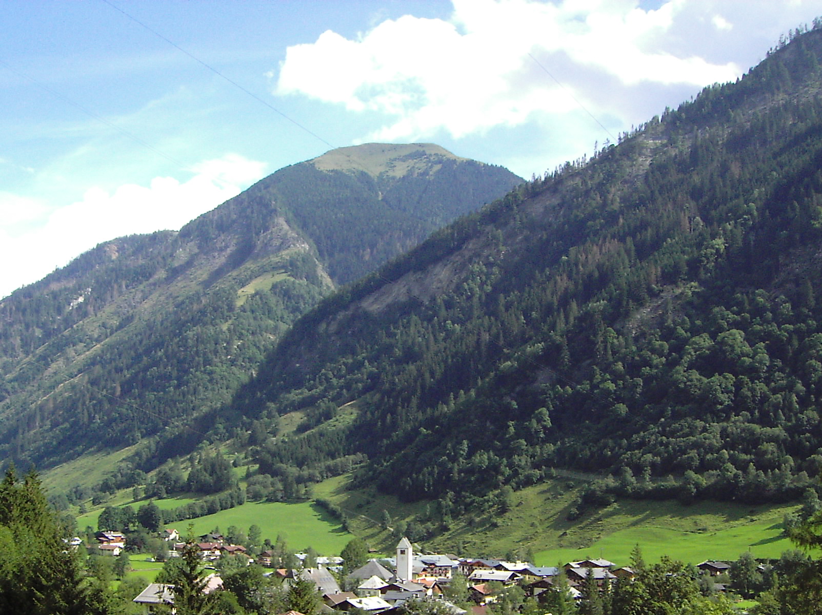 Photo: Joachim Köhler · CC BY-SA 3.0
Fusch an der Großglocknerstraße
The gateway village marks the transition from ordinary valley road to the official panoramic route.
Fusch an der Großglocknerstraße is a municipality, at the foot of Grossglockner mountain, in the district of Zell am See (Pinzgau region), in the state of Salzburg in Austria. The Fusch valley lies north of the main chain of the Alps. The population (as of December 2008) is 697.
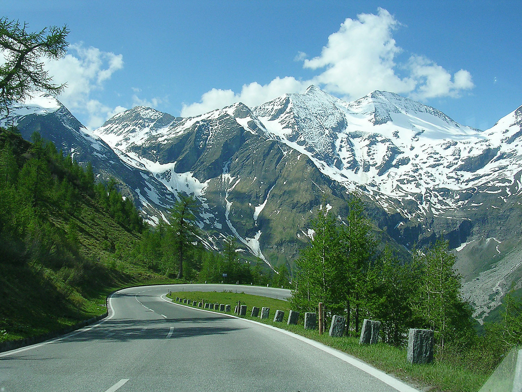 Photo: Sander Hoogendoorn from Gouda, Holland · CC BY 2.0
Fuscher Törl & Edelweißspitze
High hairpins and signed panoramas open views across dozens of three-thousand-metre peaks.
The Grossglockner High Alpine Road (in German Großglockner Hochalpenstraße) is the highest surfaced mountain pass road in Austria. It connects Bruck in the state of Salzburg with Heiligenblut in Carinthia via the Fuscher Törl at 2,428 m (7,966 ft) and the Hochtor Pass at 2,504 m (8,215 ft). The road is named after the Grossglockner, Austria's highest mountain.
 Photo: Peter300 · CC BY-SA 3.0
Kaiser-Franz-Josefs-Höhe
A visitor complex overlooks the Pasterze glacier and Austria’s highest mountain at the road’s great cul-de-sac.
The Kaiser-Franz-Josefs-Höhe (often just Franz-Josefs-Höhe) is part of the Grossglockner High Alpine Road. The end point of a cul-de-sac and lookout point is in Austria in the Glockner Group in Carinthia at an altitude of 2,369 m (7,772 ft) above sea level. The Kaiser-Franz-Josefs-Höhe can only be reached by vehicle via the Grossglockner High Alpine Road, which is subject to a toll, from both Salzburg and Carinthia.
 Photo: Angie ( talk ) · CC BY 3.0
Heiligenblut
A pointed church beneath the Großglockner creates the classic southern-side overnight.
Heiligenblut is a high Carinthian village at the southern approach to the Grossglockner High Alpine Road. Its slender Gothic pilgrimage church, traditional houses and direct view toward Austria's highest mountain make it a natural overnight after the pass.
 Photo: Bybbisch94, Christian Gebhardt · CC BY-SA 4.0
Lienz
East Tyrol’s sunny small city supplies a relaxed pedestrian center and services after the pass.
Lienz is the small administrative and cultural centre of East Tyrol, standing where the Isel and Drava rivers meet. A compact old town, nearby Schloss Bruck and sunnier valley setting give the route a gentler pause after the Grossglockner crossing.
 Photo: Dersh at English Wikipedia · Public domain
Mittersill
A Hohe Tauern gateway on the northern side breaks the Felbertauern return into a measured final day.
Mittersill is a city in the federal state of Salzburg, Austria, in the Pinzgau region of the Alps. It is located on the Salzach River. It has a population of 5,408 as of 2011.
Drive the conditions,
not the itinerary.
The road is seasonal and tolled. Check the official status, fuel before climbing, use marked pull-offs and descend in a low gear without riding the brakes.
Checked against
the people who run it
Distances and driving times are planning estimates. Conditions, closures, ferries, permits and park rules can change, so check the linked official guidance before setting out.